
Overview
Forests provide essential ecosystem services that support human well-being and play a crucial role in the mitigation of climate change. However, their health and stability are also particularly affected by recurrent climate-related disasters. Therefore, MOSAIC focuses on hazard-resilient and sustainable protective forest management, which is essential for managing climate-related risks. In order to support Alpine climate action plans, the project partners aim to collect, harmonise and share data on Alpine climate-related disasters and trends. They strive to raise awareness among foresters, risk managers, decision makers and the public through an Alpine network of forest living labs.
Factsheet
- 2021 – 2027
- Climate resilient and green Alpine region
- SO 1.1 - Promoting climate change adaptation and disaster risk prevention, resilience, taking into account eco-system based approaches
-
- AG8 Risk governance
- 11/2022
- 10/2025
- 2.710.832 EUR
- 1.758.624 EUR
Description
Climate change (CC) is undeniably responsible for the increase in climate-related disasters affecting Alpine communities. These phenomena are often the result of compound events, a combination of multiple climate-related hazards that contribute to socio-ecological risks. One of the key drivers of the increased vulnerability are changes in forest ecosystems.
Forests provide essential ecosystem services that support human well-being and play a critical role in the mitigation of CC, but their health and stability are also threatened by CC.
Therefore, MOSAIC focuses on hazard-resilient and sustainable protective forest management coping with climate changes’ multiple dimensions, which is essential for managing climate-related risks. In order to support regional and Alpine climate action plans, the project aims to collect, harmonize and share data, models on Alpine climate-related disasters and trends. The project partners strive to raise awareness among foresters, risk managers, decision makers and the public through an Alpine network of forest living labs.
MOSAIC is an action-research project that relies on project partners recognized for their applied research activities and involvement in the science-decision-action triptych.
Project main activities
MOSAIC is structured in 3 distinct work packages:
1-DOJO: Data mining and prOJection of climate change effects on the Alpine Space fOrests.
2-NAZCA: NaturAl haZards modelling platform for analysing climate change Compound events on AS protective forests.
3-FORCE: Forest labs fOr Raising awareness on resilienCe of protectivE forest coping with climate change adaptation.
- MOSAIC will provide:
-Comprehensive stocktaking and assessment of spatially explicit past and projected climate (2050-2100 according to IPCC scenarios) and climate-related disaster data for the Alpine Space, made accessible via a webGIS atlas.
-A platform offering natural hazard and risk models upgraded for integrating the consequences of climate change on Alpine Space forests and on their ability to efficiently protect against natural hazards.
-Provision of data, experience and knowledge to support the definition of a Joint Alpine scheme for implementing an integrated and adaptive management of Alpine Space forests with protective functions that are coping with climate change impacts.
Partners
- 45.199246010328675.773273191890801
- 44.56785156.089946809722225
- 45.0693797.6897242
- 45.407717211.8734455
- 45.437190812.3345898
- 48.178268416.302980305239764
- 48.067791116.35761591656314
- 46.050257714.478203754281509
- 46.052427814.4800014
- 46.99154317.468211765711086
- 46.81203559.8473554
- 51.55837579.9560718


Outcomes
-
The first Alpine Climate Change webGIS atlas
An interactive webGIS platform that will provide open access to the results of 1) data mining & databases, 2) analyses of observed trends & projections, and 3) WP2&3. This atlas of spatially explicit data on climate change and related disasters will be a unique platform to visualise and assess historic and future information, e.g. on hotspots of multidimensional compound events identified in WP1&2. -
NAZCAlp : NaturAl haZards Calibrated model platform for Analyzing impatcs of CC compound effects on AS protective forests.
Incorporating upgraded natural hazard, vulnerability and risk models for locally evaluating impacts of CC (e.g. forest mechanical properties) and compound events (e.g. simultaneous occurrences of severe drought and wildfire) on the protective effects of AS forests in established open-access platforms, e.g. www.ecorisQ.org. The models will be applied in compound events hotspots identified in WP1 to evaluate CC-related socio-ecological risks under current and projected conditions (2050 and 2100). -
Catalogue of illustrated fact sheets for supporting integrated and adaptive forest management of Alpine forests with protective functions in climate action plans
Catalogue will be based on results from all WPs and FLLs. A collection of best practices and silvicultural measures for forest resilience and CC adaptation in AS protective forests will be presented with an illustrative approach. FLLs (research/demonstration plots) will be set up in the hotspots areas identified in WP1 and will serve as a research, training and awareness raising tool for different TG and will enable to virtually test and evaluate different management options.
Pilots
-
Marteloscope France: Prélenfrey (municipality of Le Gua, Isère)


 The marteloscope site of Prélenfrey was established in 2023 and is now part of the European Forest Institute (EFI) Integrate Network.
The primary focus of the site's establishment is to virtually test the effects of different forest management strategy on the forest's protective function against rockfalls and snow avalanches risks. For this purpose, two specific indicators have been developed (F. Berger and S. Dupire INRAE-LESSEM Grenoble) and implemented in the forest dynamic model SAMSARA (developed by B. Courbaud INRAE-LESSEM Grenoble, and used in the MOSAIC’s marteloscopes). SAMSARA allows to analyze virtually the evolution in time of different indicators (not only the protection ones but also biodiversity, timber quality, economical ones) according to the forest management strategy adopted. The I+ Trainer, developed by the European Forest Institute and designed for mobile devices such as tablets and smart phones, is also used for conducting the initial step (trees virtual marking) of marteloscope exercises in the field. The marteloscope covers an area of 1hectares with a mixed forest stand of 645 trees (all numbered, described and mapped). It will be used for foresters training, raising awareness of policy decision makers about protective forest management and problematics, as a support for researchers exchanges, and for great public educational actions. -
Forest Living Lab Italy: Agordino Valley


 The Forest Living Lab of the Agordino Valley (Cordevole basin) has been selected to study the impacts of several disturbances (wind, fire, bark beetles, avalanches) on forest stands regeneration dynamics, protective function, and ecosystems services provisioning. It has an extension of 870 km2. In October 2018 the storm Vaia severely impacted the forest, mainly Norway spruce forests. Norway spruce is the most represented species, followed by larch, dwarf mountain pine, beech, Norway maple, ash and many other species. The elevation gradient ranges between 600 m a.s.l. and 3343 m a.s.l.
 -
Forest Living Lab Italy: municipality of Rocca Pietore


 The Rocca Pietore Municipality has an extent of 74 km2 of which 52% is covered by forests. The Vaia Storm in 2018 abated 20% of the forests in the sudy area. The area is selected to develop a new procedure to semi automatically derive the forest vulnerability against windstorms. The selected model is FORESTGales that allow the calculation of vulnerability at single tree level. The procedure tested in this area can be applied at regional scale if LiDAR data are available. In this area the forest dynamic model TreeMig is tested to simulate the evolution of the forests after the occurrence of the windstorm and understand the future forest wind vulnerability for different scenarios. Field surveys on the mechanical properties of the trees are also carried out in Boscoverde (a locality within the municipality of Rocca Pietore)
 -
Study site of Taibon Agordino


 This area in the Taibon Agordino municipality has been affected by a high severity wildfire from 24 to 27 october 2018, the fire was extinguished by the storm Vaia, burning approximately 632 ha. Due to storm Vaia also some windthrowns occurred in the area after the fire. Surveys on short-term post fire natural regeneration dynamics are carried on in this area, coupling remote sensing data and field data about soil cover, ground cover, deadwood, and forest regenerations species abundance.
 -
Study site of Caracoi (municipality of Rocca Pietore)


 The area of Caracoi has an extension of almost 200 ha and it was a mature even aged forest of Norway spruce. The storm Vaia felled almost 663 ha (whole municipality) and the subsequent bark beetle outbreaks killed more than 50 ha of pure Norway spruce forest. The natural regeneration dynamics is monitored within the damaged patches with 100 % mortality.
Short term natural regeneration dynamics surveys are conducted in 4 sites in the upper Agordino valley. The protocol adopted consists in four plots where to record regeneration species abundance, soil cover, soil sample, and deadwood data. The four plots have been displayed along a transect line starting from the living forest edge. Forest regeneration has been divided into three different classes according to height: <20cm, 21-150 cm, >150cm. Browsing damages are also recorded. -
Study site and marteloscope of Nevegal (Belluno municipality)
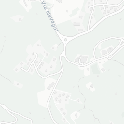


Short term natural regeneration dynamics surveys are conducted in 2 sites in Nevegal. The protocol adopted consists in four plots where to record regeneration species abundance, soil cover, soil sample, and deadwood data. The four plots are displayed along a transect line starting from the living forest edge. Forest regeneration has been divided into three different classes according to height: <20cm, 21-150 cm, >150cm. Browsing damages are also recorded. A marteloscope will be installed by the end of 2024. The marteloscope will consider the risk of rockfall, avalanche, shallow landslides, wind and barkbeetle. The forest characteristics that will be collected, will allow the simulation of possible forest dynamics through the use of the Samsara simulation model.
-
Study site of Col di Lana (municipality of Livinallongo del col di Lana)



 The study area has an extent of 5 ha and it was a mature forest of spruce before the Vaia strom. The Vaia Storm in 2018 abated 95% of the trees. The area is selected to monitor the propension of snow avalanches formation in windthrown areas. The roughness of the study site is surveyed in snow-free conditions to investigate the evolution of stems on the ground and derive indicators of snow avalanches propensity to be applied at regional scale. Field surveys on the mechanical properties of the trees are carried out too.
 -
Study site of Franza (municipality of Livinallongo del col di Lana)


 The study area has an extent of 10 ha and it was a mature forest of spruce with the presence of larch. The Vaia Storm in 2018 abated 80% of the trees. The area is selected to monitor the propension of snow avalanches formation in windthrown areas. The roughness of the study site is surveyed in snow-free conditions and also with the snow cover to investigate the evolution of the stems on the ground and derive indicators of snow avalanches propensity to be applied at regional scale. Field surveys on the mechanical properties of the trees are carried out too.
 -
Forest Living Lab Italy: Bussoleno and Mompantero
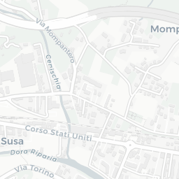


 The area is located in the municipalities of Bussoleno and Mompantero and in October 2017 was affected by a mixed severity wildfire with an extent of around 4000 hectares. The aims of the studies conducted in the Mompantero pilot site includes the analysis of short-term natural regeneration patterns and their drivers and the experimentations about different active restoration techniques, including salvage logging, planting, and seeding. A long-term monitoring project about natural regeneration is carried on in the Scots pine stands affected by the fire. In those patches with scarce natural regeneration probabilities active restoration techniques were adopted aiming to compare the effectiveness of different approaches. Trials on seed predation rates are carried on. Finally, focus groups were established with different categories aiming to understand their knowledge regarding the effects of wildfires, and post-fire management techniques. The stakeholders involved are: Piedmont Region, Metropolitan City of Turin, Mompantero Municipality, forest technicians, forest owners, policy makers, local administrators, and citizens of the area.
 -
Marteloscope of Bourra (municipality of Verrayes)
Download


 The Marteloscope Bourra is a 1ha forest plot set in a protective Scots pine forest close to the wildfire of Bourra, in the municipality of Verrayes (Aosta, Italy). The objective of this marteloscope is to improve forest management (thinning) in protective forests to improve the protective function related to compound disturbances (especially wildfires). The main stakeholders that will use this marteloscope are foresters, forest managers, forest owners, the Municipality of Verrayes, and general public.
 -
Forest Living Lab Slovenia – Soteska, Bohinj
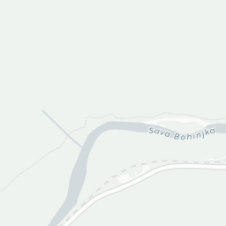


 The marteloscope of Soteska is part of this Forest Living Lab, and sets in a protective forest with highly emphasized protective function. This forest protects a railway and bicycle path against falling rockfalls, torrential and landslides hazards.
The use of this Marteloscope is to train management in protective forests in order to improve and increase their stability and resistance, and with this their protective role, especially in times of increased natural events.
The main stakeholders that will use this Marteloscope are the Slovenian Forest Service foresters, forest managers, other environmental companies, forest owners, Ministry of agriculture, forestry and food, Triglav national park, GG Bled company, Railway and road company, Municipalities of Bled and Bohinj, and general public. -
Forest Living Lab Slovenia - Smarna Gora - Ljubljana


 Pour le: read full post
The marteloscope of Soteska is part of this Forest Living Lab, and sets in a protective forest with highly emphasized protective function. This forest protects a railway and bicycle path against falling rockfalls, torrential and landslides hazards.
The use of this Marteloscope is to train management in protective forests in order to improve and increase their stability and resistance, and with this their protective role, especially in times of increased natural events.
The main stakeholders that will use this Marteloscope are the Slovenian Forest Service foresters, forest managers, other environmental companies, forest owners, Ministry of agriculture, forestry and food, Triglav national park, GG Bled company, Railway and road company, Municipalities of Bled and Bohinj, and general public. -
Forest Living Lab Austria - Model Catchment Rindbach


 The Model Catchment Rindbach serves as the designated Forest Living Lab in Austria, established to address challenges in protective forest management. Located in the Rindbach watershed near Ebensee (Upper Austria), this torrential catchment is a long-term natural laboratory (>30 years) for research, monitoring, hands-on training, and knowledge transfer. The Model Catchment is operated in partnership with the Austrian Protective Forest Hub (https://www.protective-forest.at/protectiveforesthub.html), a collaboration between the Austrian Federal Ministry of Agriculture, Forestry, Regions and Water Management (BML), the Austrian Service for Torrent and Avalanche Control (WLV), the Österreichische Bundesforste AG (ÖBf), the BOKU University and the BFW. The hub coordinates nationwide initiatives, facilitates knowledge exchange, and connects diverse stakeholders focused on protective forests.
The main goal of the Rindbach Model Catchment is to enhance understanding of the interactions between forestry, geology, hydrology, and gravitational natural hazards. The East-to-West oriented watershed covers 23.1 km² of mixed forests, with its highest point at 1,598 m above sea level (Eibenberg), located just below the natural tree line.
In July 2024, a Marteloscope was installed within the Forest Living Lab’s protective forest. This tool will support practical forest management training and knowledge-sharing activities for forestry professionals, students, researchers, and the public. -
Marteloscope Switzerland: Dischma (canton of Grisons)


 The marteloscope site "Dischma" was established in 2015 as part of the European Forest Institute (EFI) Integrate Network. Located in the Dischma Valley near Davos, in the canton of Grisons, Switzerland, the site sits at an elevation of 1830 meters above sea level and is privately owned. The primary focus of the site's establishment was to study the forest's protective function and natural regeneration processes.
The forest at the marteloscope site “Dischma” is a subalpine Norway spruce-larch forest, covering an area of 1.5 hectares. It consists of 67% Norway spruce (Picea abies), 32% European larch (Larix decidua), and 1% rowan (Sorbus aucuparia). The forest has an average of 325 trees per hectare, with a basal area of 62.4 m² per hectare. The site's climate is characterized by a mean annual precipitation of 1060 mm and a mean annual temperature of 3.9°C.
The Dischma site is regularly used for excursions and serves as a platform for management discussions with local foresters and cantonal administrations.
Additional details about the “Dischma” site can be found in this information sheet: http://iplus.efi.int/uploads/CH_InfoSheet_Dischma_en.pdf
Gallery
- Field-trip-first-project-mamanagement-meeting-AustriaMOSAICField trip first project management meeting Austria 2023
- 10th-International-Wind-and-Trees-IUFRO-Conference-2023MOSAIC10th-International-Wind-and-Trees-IUFRO-Conference-2023
- Exchanges-with-Swedish-students-2024MOSAICExchanges-with-Swedish-students-2024
- Excursion in a Swiss marteloscope 2023MOSAICExcursion-in-a-Swiss-marteloscope-2023
- Excursion with Ukrainian delegates of national parks 2024MOSAICExcursion-with-Ukrainian-delegates-of-national-parks-2024
- Field training of student 2023MOSAICField-training-of-student-2023
- Group picture field trip 2024MOSAICGroup-picture-field-trip-2024
- Group picture of the first project management meeting 2023MOSAICGroup-picture-of-the-first-project-management-meeting-2023
- Page 1
Downloads
- Download
- Download
- Download
- Download
- Download
-
Download
This report serves to catalogue the data to be provided by the project partners in the scope of the MOSAIC project to achieve the objectives of the project; namely, to analyze past and future trends of climate-change related impacts. The contents of this report, as part of D.1.2.1, are current as of the most recent version date. Changes to data availability are expected throughout the course of the project, which runs for 36 months. The data sets in this catalogue and report have been surveyed or identified by partners of the project consortium and have been or will be provided for analysis and eventual visualization on the web GIS atlas to be produced as the pinnacle of project’s WP1. The available data are comprised of a combination of open-source, closed-source, and visualization-only data sets, and are marked as such.
As of the publishing date of this version of the report, there are a total of 48 maps, layers, or other data identified for the project and thus included in this report. Categories have been identified and defined to help group data sets. -
This deliverable is a report aiming to provide a cohesive definition of hotspots within the scope and context of this project. The shared definition harmonizes work by partners and allow clear discussions and progress in relation to hotspots. In addition, this deliverable aims to describe the context of this project and the decision-making behind our selection of a shared definition, as well as the methodology used to map the hotspots on the project's webGIS atlas.Download
-
Rey F., Dupire S.,Berger F. 2024. Forest-based solutions for reconciling natural hazard reduction with biodiversity benefits. NBSJ_100114. The authors’ version is available here.Download
-
Sever K, NEVE REPE A., POLJANEC A. Slovenian workshop on protective forest. 14.02.2023. Text in slovenian hereDownload


