Overview
There is scientific evidence that climate change is likely to induce more frequent or intense weather extremes in the Alps with compound and cascading effects on the environment, humans and the economy. This may induce unexpected complex, long-lasting or even irreversible consequences. However, the knowledge and management of cascading impacts and risks under climate change are still insufficient. Therefore, X-RISK-CC aims to support risk managers and policy makers in addressing the compound risks of climate change extremes by developing new knowledge, local risk management actions and transnational guidelines. The project partners thus explicitly address the need for common knowledge, actions and solutions to manage extremes in the context of climate change.
Factsheet
- 2021 – 2027
- Climate resilient and green Alpine region
- SO 1.1 - Promoting climate change adaptation and disaster risk prevention, resilience, taking into account eco-system based approaches
-
- AG8 Risk governance
- 11/2022
- 10/2025
- 2.982.073 EUR
- 2.017.377 EUR
Description
In recent years, the Alps have been affected by unprecedented weather extremes such as heatwaves, heavy rains and storms with severe impacts on the environment, humans and the economy. The Alpine territories involved in the project report that such events overstrained their risk management capacities. The unexpected magnitude and intensity of these extremes can in fact cause ‘compound’ impacts and domino effects (more than one impact happening simultaneously or subsequently) that turn into complex, long-lasting or even irreversible consequences.
While there is recent scientific evidence of climate change (CC) attribution to the increasing intensity and frequency of such events, knowledge and management of their cascading impacts and risks are still insufficient. On the regional level, such events are not considered in current Disaster Risk Reduction (DRR) mechanisms. Climate Change Adaptation (CCA) plans, if they exist, often underestimate domino effects and compound risks related to extreme events and miss concrete solutions.
X-RISK-CC helps risk managers and policy makers across the AS to address the compound/cascading risks of CC-related extremes by developing local actions and transnational guidelines. They are based on newly generated and harmonized Alpine-wide data and knowledge on past and future extremes. The actions for upgrading current risk management instruments are designed with risk managers in five pilot areas in the AS (incl. cross-border areas). The project outputs are co-developed by and disseminated through EUSALP AG8 and PLANALP of the Alpine Convention (AlpConv). X-RISK-CC partnership includes regional risk managers, national authorities, members of EUSALP and PLANALP/ACB of AlpConv and scientists. It explicitly responds to the need for common knowledge, actions and solutions for managing extremes under CC that will be expressed in the EUSALP AG8 2023-24 work programme.
Partners
- 46.072192311.1212361
- 46.065384214.5129303
- 46.1639070514.306674164430577
- 45.77163274.8649712
- 48.24862595000000516.356562264678487
- 47.26565311.3974589
- 48.1509072511.568554408489021
- 48.2271985516.363632975256742


Outcomes
-
Digital library on past and future weather extremes across the AS including the webGIS platform and the tailored studies for the pilots - How to exploit the new knowledge and data for practice
The digital library includes the webGIS platform, explanatory materials for its use (A 1.3), and a summary report on past and future trends in weather extremes across the AS (A 1.2), with additional details for the pilots (A 1.1). It is a unique easy-access point for the WP1-target-audience to uptake new Alpine-wide knowledge and contributes to the final O4.1. It includes data factsheets, guidelines for data interpretation and how-to tutorials to ease the uptake for impact/risk studies (WP2). -
X-RISK-CC manual: A conceptual approach designed for risk managers/practitioners to support them in assessing and coping with the newly emerging risks of weather extremes in their area
The manual bridges the gap between the newly created knowledge (WP1-2) and its straightforward exploitation by the WP3-target-audience to develop concrete risk management and adaptation options in a AS context (WP3). It guides them in understanding, assessing & coping with current and future compound impacts/risks in the pilot areas, using the information provided by the digital library (O1.1) and the risk pathways outlined in A 2.2. The manual is designed to be transferable across the AS. -
Pilot area dossiers
The dossiers will be completed for each pilot in English and local language to foster the dissemination and implementation of tailored pilot actions. The dossiers contain a description of the pilot situation and the outcomes of the pilot participatory processes. The dossiers are intended to disseminate the built pilot knowledge to the general public: from CC-related extremes to associated risks. -
Pilot action plans of tailored risk management measures to be developed in the pilot areas to cope with increasing weather extremes and their compound impacts/risks
The action plans concretize O2.1 in the 5 pilots & engage the pilot PPs & the WP3-target-audience to implement measures and developed actions. O3.2 also outlines further steps needed to manage risks of increasingly emerging weather extremes. The action plans contain background information, the current status of each pilot, reasoning and design criteria of developed measures as well as an overview of the next steps to ensure their long-term implementation. -
Two-tier digital sourcebook
The two-tier digital sourcebook synthetizes the WP4 outcomes & makes them available to policy makers and practitioners across the AS. It includes a synthesis section with transalpine risk-management gaps & corresponding priorities for coping with emerging extremes & compound risks (1st tier). The 2nd tier provides transferable guidelines for risk management practice & strategic policy options to integrate the new knowledge on weather extremes & compound risks into DRR/CCA across the AS.
Pilots
-
Garmisch-Partenkirchen
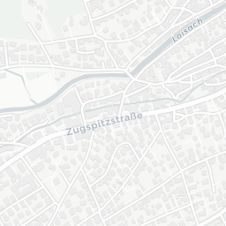


The Garmisch-Partenkirchen region is exposed to mountain hazards such as rock slope failure, rockfalls, debris flows and hyperconcentrated flows, massive sediment transport from rivers, avalanches and coupled multirisks. Recurrent extreme precipitation events in the last 3 decades caused well-documented multirisk events and show a clear dependency on intense summer rainstorms including the Hammersbach, Ferchenbach & Partnach Catchments, especially the Reintal- and Höllental and the touristic Partnachklamm & Höllentalklamm affected by multiple events e.g. in 1991, 2005, 2007, 2018/19, 2020 and 2022. Damages and hazardous process have been recorded over at least three decades providing a unique data set on rock slope failure, rockfalls, debris flows and hyperconcentrated flows and massive sediment transport events. Multi-risks have been well-documented and play a major role in the catchments and the touristic vicinity of the 30,000 inhabitant city of Garmisch-Partenkirchen. The clear link to intense summer precipitation makes the region especially susceptible to changing rainfall intensities in the foreseeable future in a changing climate. Risk-related management practices are already in operation but need to be updated for extreme and coupled events.
-
Gorenjska region, Slovenia


Gorenjska region, more precisely the the Sora Basin, is a part of pre-Alpine/Alpine region in NW Slovenia. The most common weather events that affect the study area are droughts (agricultural, ecological and hydrological droughts) in combination with heatwaves, including flash droughts, river floods and flash floods. Co-occurrence of persistent dry conditions and high temperatures (heatwaves) leads to drought and several cascading impacts in different sectors - agriculture, forestry, local water supply, tourism, hydropower and ecosystems. Flash floods in combination with extreme precipitation cause the destruction of vegetation cover, damage on infrastructure etc. There is increasing trend of these weather events in the region, especially after 2000. In some years, the region was faced with a combination of different extreme weather events and their cascading/compound impacts. For example, in the year 2012, the region was faced with a combination of long-lasting hydrological drought, heatwaves and agricultural drought in the summer, and floods in the fall, which led to the synergy of various impacts.
In 2007 one of the worst natural disaster related to extreme weather event occurred in the area. In September 2007 an extreme rainfall event affected approximately one-third of the country. In the town Železniki, the observed maximum daily amount of rainfall was nearly 200 mm, which was the highest recorded amount of rainfall since the beginning of the measurements in 1930. The accumulated rainfall resulted in a flood event that by far exceeded the 100-year return period of maximal floods. The flash flood triggered by the intense precipitation devastated the town of Železniki: three people lost their lives, while it was estimated that the flood caused nearly 100 million Euros of damage.
-
Val di Fiemme (Autonomous Province of Trento), Carezza and Latemar Area (Autonomous Province of Bolzano)


In 2018, an event of intense rainfall and strong winds, called “Vaia”, affected the entire Central Alps, leading to the collapse of large forest areas and flooding events on both the minor and main network, with debris flows and flooding. The immediate effects of the event were evacuations, disruptions of road and technological network, even for long periods, both liquid and sediment flooding on large surface areas including settlements and agricultural land, and damage to river and torrent hazard mitigation measures.
The vast areas affected by the crashes also involved steep slopes that became new potential avalanche areas. Shortly after the storm they were indicated in the “hazard map” (“Carta/Mappa della Pericolosità”) of the Province of Trento and Province of Bolzano as potential avalanche hazard areas.
An expert study is required before making any modification to these areas. Another effect of extensive crashes is the increase of erosion-prone areas connected to the hydrological network and the alteration of the hydrological cycle, with a likely faster and more intense response to precipitation.
These areas, full of decaying wood, have later become open to bark beetle proliferation, which has proliferated in the last three years, affecting large areas outside the crashes and extending the modification in hydrologic, hydraulic and avalanche hazard. The aim of the project is to produce guidelines on how to deal with risk in these areas now, a few years after the storm: how to manage the regrowing forest from the point of view of the provincial Services for avalanche, torrent control and forest management, as well as from the Civil Protection perspective.
-
Wipptal (ITA) + Stubaital (AUT)
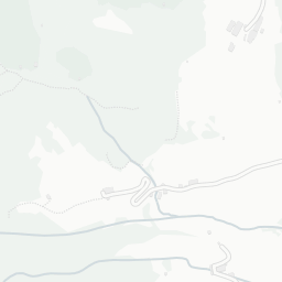


 In the late afternoon of 08.16.2021, heavy rainfall in the Fleres valley caused widespread and extensive erosion phenomena in the Rio di Toverino basin. In the upper part, the debris of the Wetterstein dolomites found on the northern slopes along the ridge between the Seebergspitz, the Telfer Weißen and the Toffrinig-Lotterscharte was mobilized by reactivating the existing incisions. Most of the mobilized dolomite debris, ca. 25,000 m³ - 35,000 m³, was deposited on the gently sloping meadows at an altitude of approx. 1,580 m a.s.l. Further downstream there are only traces of dolomitic material. It can therefore be hypothesized that the flood wave, once the material was deposited in the middle basin, began to erode again in the downstream section, characterized by darker substrates; from an altitude of 1,425 m a.s.l. up to the apex of the alluvial fan, at about 1,200 m a.s.l., there were both widespread phenomena of slope erosion and deep erosion of the riverbed, which also reached depths of 2 - 2.5 m. Of note are the large quantities of timber mobilized and deposited in the valley. According to estimates, between 35,000 and 45,000 m³ of debris were deposited on the fan of the Rio di Toverino, which, added to the deposits in the middle basin, lead to a total of between 60,000 and 80,000 m³. The Rio di Fleres, following the blockage caused by the debris of the Rio di Toverino, underwent a drainage on the left orographic side, flowing between the buildings of the Botenhof, Kienast and Perl farms, on the state road and finally in its original bed, at the intersection of the LS35 with the access road to the Teissl farm. Several buildings were damaged, in particular number 117, where the regurgitation of the Rio Fleres heavily flooded the ground floor and the basement. Various infrastructures were also affected, including the hydroelectric derivation of the Toverino plant, which in turn was flooded, with interruptions in the power supply; two bridges on the provincial road were damaged, effectively isolating the hamlets upstream. Various sections of the forest and alpine roads were also submerged by debris.
 -
Val d'Arly, France


 The event at the end of December 2018 linked to storm Eleanor, which caused multiple episodes of rain on snow, caused flooding in small watersheds in the Northern Alps (Haute-Savoie, Savoie and Isère) and the triggering superficial landslides and torrential lavas where, historically, these phenomena were exceptionally rare.
On soils saturated with water, floods, landslides and mudslides have destroyed chalets and road infrastructure, particularly in Val d'Arly.
The suddenly rising of the rain-snow limit, following heavy falls, consequences of storm Carmen, was followed on January 2 and 5, by heavy rains and snowfalls.
In addition, the road network was heavily impacted by the avalanches, strongly influenced by the return from the East that occurred after the passage of the two storms. The large-scale aerosol caused extensive damage to the forest and caused material damage far in bottom of valleys, with a mixed flow over a wetter snowpack at lower altitudes.
Project calendar


